
-
Mapping Land Use / Land Cover Codes from NLCD1992 to NLCD2011
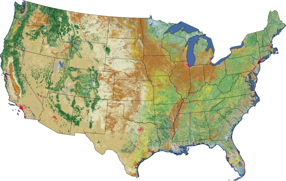
If you do chose to use land use data from the USGS that is more recent than 1992 (NLCD for 2001, 2006, and 2011), be aware that the classification schema for the newer data is slightly different. The table below show the mapping for the classification codes. Mapping of LULC Codes Between NLCD1992 and NLCD2011 […]
-
How to Find Data for AERMET: Surface Data
We are all familiar with buying a product that requires assembly, typically furniture or some kind of toy-like contraption if you have kids. The expectation is there will be a list of parts (all identified), a list tools necessary for the assembly, and instructions taking you step-by-step through the process. Sometimes, there are pictures and […]
-
Selecting Weather Stations for Dispersion Modeling
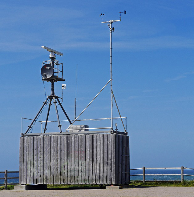
This article has been updated. To see the new version, go here. AERMET Made Easy: Selecting Weather Stations “The determination of representativeness should include a comparison of the surface characteristics (i.e., zo, Bo and r) between the NWS measurement site and the source location, coupled with a determination of the importance of those differences relative […]
-
Welcome to NaviKnow…..

A couple of years ago, I was sitting in a sandwich shop in Brooklyn enjoying a meal and drink while reading a guidance document on dispersion modeling (yes, I am dedicated). I went through a paragraph or two describing the proper procedures to follow. It wasn’t clear the first read through, so I read it […]
-
AERMET Made Easy (Preview) – FREEBIES
Thanks for attending the December 13th webinar on What You Need To Know Before You Use GIS. As mentioned in the webinar, here are the resources and freebies. AERMET Data Resources (PDF) AERMET Surface Data File Format We’re looking for feedback! Please take a moment to complete this short survey. Feedback Survey
-
What You Need To Know Before You Use GIS – FREEBIES

Thanks for attending the November 15th webinar on What You Need To Know Before You Use GIS. As mentioned in the webinar, here are the templates and checklists. KML Templates (PDF) Map Projection Settings
-
3 Ways to Increase Productivity in Dispersion Modeling – FREEBIES

Thanks for attending the November 11th webinar on 3 Ways to Increase Productivity in Dispersion Modeling. As mentioned in the webinar, here are the templates and checklists. Course Curriculum SOP For Generic Modeling SOP Linking DB to Word Report SOP Site Location Representation
-
Air Quality Data: The Foundation for Rules, Policy, Permitting, and Compliance and the Power it Possesses – FREEBIES

Thanks for attending the October 18th webinar on Air Quality Data: The Foundation for Rules, Policy, Permitting, and Compliance and the Power it Possesses. As mentioned in the webinar, here are the templates and checklists. List of Agency Data Sources [PDF] Link to Air GeoDatabase [Link]
-
What You Need To Know Before You Use GIS – FREEBIES
Thanks for attending the August 23rd webinar on What You Need To Know Before You Use GIS. As mentioned in the webinar, here are the templates and checklists. KML Templates (PDF) Map Projection Settings